|
Tim Dawson
|
|
|
Group: Forum Members
Posts: 8.2K,
Visits: 9.7K
|
I said we would make georeferenced airfield diagrams available in Switzerland and we have done so, see screenshot below. I am not sure the point of your screenshot of a Canadian map.
|
|
|
|
|
Serge
|
|
|
Group: Forum Members
Posts: 34,
Visits: 263
|
Super thanks, this makes taxing much easier :-) Would it also be possible to have for LSZH the north and south appron as georeferenced airfield diagrams? As they are much more granular with the taxi ways 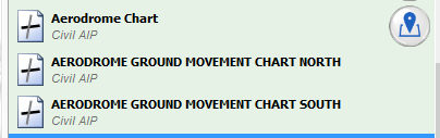  Thanks and again super work.
|
|
|
|
|
Tim Dawson
|
|
|
Group: Forum Members
Posts: 8.2K,
Visits: 9.7K
|
We will do what we can. Those two will definitely be done within 24 hours.
|
|
|
|
|
Sky Painter
|
|
|
Group: Forum Members
Posts: 627,
Visits: 15K
|
+x+x+x+x+x+xYou should see the standard georeferenced button next to many airfields in Switzerland now. If the chart has been downloaded, it'll pop up automatically when you land. I don't see any geo-referaenced button next to Airfields. Only things happening, when I land and stop, sometimes it will turns into a Plate of this Aerodrome. I have re downloaded Swiss charts again. Still no go, maybe you can tell me which should I have download and where to get it. BTW, I'm no more on Android, it is iPad at the moment. Maybe you are talking about Android? or I don't know anymore.. It may help if you read Page 44 of the SD Manual. I don't see any geo-referaenced button next to Airfields. Only things happening, when I land and stop, sometimes it will turns into a Plate of this Aerodrome. I have re downloaded Swiss charts again. Still no go, maybe you can tell me which should I have download and where to get it. BTW, I'm no more on Android, it is iPad at the moment. Maybe you are talking about Android? or I don't know anymore.. It may help if you read Page 44 of the SD Manual. Sky Painter, this is second time you are answering me, both were wrong.. Maybe you should read carefully my thread before answering. I'm talking about Taxi Ways. With theire in and out names (C,B,A etc. and "C" Office, real Airfield Ground and Taxi fascility. But not about Plates, Capiche.. Cocoroman, there is no need to vent your obvious frustration and anger on me. Your posts seem to indicate a basic lack of understanding of georeferenced charts in general and how they work within the context of SD and in an effort to be helpful, I pointed you towards Page 44 of the SD Manual firstly, because it has a clear image of the blue georeference button and secondly, it explains how georeferenced charts work in SD. Furthermore, it seems to have escaped your notice that you cannot display taxiways without first displaying an airfield plate. Yes, that's right — a plate! No plate — no taxiways! If I want to navigate my way around my local airport's taxiways, I first load the airport's georeferenced plate. Capiche! When all is said and done, this is a Help Forum. If you want help, it does you no credit at all to vent your anger and frustration on any respondent trying to do just that — help! My response to you was not "wrong" per se, but I can understand that you might consider it to be irrelevant, in which case you should perhaps try to ensure that in the future your posts are more specific and less ambiguous. You are now on my "ignore list".
Mike _________________________________________ Samsung Galaxy Tab A8 – Android 11.0 & SD 4.1.2 Huawei P30 – Android 11.0 & SD 4.1.2
PC – Windows 10 (Home Ed) Version 22H2, Build 19045.6396, SD 4.1.2
|
|
|
|
|
cocoroman
|
|
|
Group: Forum Members
Posts: 70,
Visits: 116
|
+xI said we would make georeferenced airfield diagrams available in Switzerland and we have done so, see screenshot below. I am not sure the point of your screenshot of a Canadian map. I put this that I've found on Garmin didn't even checked was Canadian or from Kongo. Just to show how it is presented on the Software. Your .jpg file is in Switzerland and well showed and that georeferenced charts are working, thats why I'm screaming since two days, that I can't see those georeferenced taxi charts on my SD. And thats why, I am asking how to do it. Because simply, I can't see them like you do. And question was, where from that I should download them etc. Anyway, I'm finished here. Thanks for your help..
|
|
|
|
|
Tim Dawson
|
|
|
Group: Forum Members
Posts: 8.2K,
Visits: 9.7K
|
It may help if you read Page 44 of the SD Manual.
|
|
|
|
|
cocoroman
|
|
|
Group: Forum Members
Posts: 70,
Visits: 116
|
+xIt may help if you read Page 44 of the SD Manual. Yes, I did read Page 44, X times. Problem is not there, the problem is you guys gave to some countrys, Like Germany, G.B. and the others. Obviously they have all the charts and Ground & Taxi what they need. But some how not for Switzerland, now after my insisting a days you are starting to doing, as well we have purchased but we don't have same previliges as the others. I have checked again tonigt. There are many important Airfields are missing of Aerodrome Charts ( Though I gave you the list). Maybe it will come later.We're paying same amont of money pro portioanal, and legally we should have same Aerodrome charts like the others, and this is our right..
|
|
|
|
|
cocoroman
|
|
|
Group: Forum Members
Posts: 70,
Visits: 116
|
+xI said we would make georeferenced airfield diagrams available in Switzerland and we have done so, see screenshot below. I am not sure the point of your screenshot of a Canadian map. Yeah, plus Military Plates and Aerodrome Charts (Buochs & Payern), nobody will fly in except maybe Military Planes:-)) Still waiting for the list that I gave. We Swiss Pilots are flying on those Airfields BTW ..
|
|
|
|
|
Tim Dawson
|
|
|
Group: Forum Members
Posts: 8.2K,
Visits: 9.7K
|
I am pretty sure we have georeferenced all Swiss airfield aerodrome plates. You're welcome.
Obviously we cannot georeference a plate which does not exist. Perhaps some of the airfields you listed do not actually have official plates published by the Swiss authorities, so there is nothing for us to georeference.
|
|
|
|
|
cocoroman
|
|
|
Group: Forum Members
Posts: 70,
Visits: 116
|
+x[quote]I am pretty sure we have georeferenced all Swiss airfield aerodrome plates. You're welcome.
Obviously we cannot georeference a plate which does not exist. Perhaps some of the airfields you listed do not actually have official plates published by the Swiss authorities, so there is nothing for us to georeference. Hi Tim, sure I forgot to thank you for something that I have paid. I,m really sorry to forgot to say my thanks. Thank you very much indeed. Coming to the thing; I've never talked about Plates, but about "TAXI FACILITIES" the list I gave you, are most visited Airfields in Switzerland. But hey, I'm taking your word, go for it. Honestly I don't know if I'm gonna stay with SD. Because today, I've made a flight (A real) from LSGN to LSZB, imagine all was lagging behind, means: it never showed up VAC approach, never showed Taxi and Parking etc. unless I would have touch it to make it activated(Though I have really well setup). On the flight back, I have tried "Flite Deck VFR Mobile Jeppesen. Funny but, all was there and zooming in and out as they should have to be. I'm still saying, SD is the one of the most powerful Aviation Software. But please keep it that way, instead of taking a head with your members. This is a forum page, and I say to the whole forum, what I see and get.Thank you..
|
|
|
|