Important: These forums are for discussions between SkyDemon users. They are not routinely monitored by SkyDemon staff so any urgent issues should be sent directly to our Customer Support.

Virtual Radar situational awareness not sufficient


Author
Message
Gerhard66
G
Too Much Forum (5.8K reputation)Too Much Forum (5.8K reputation)Too Much Forum (5.8K reputation)Too Much Forum (5.8K reputation)Too Much Forum (5.8K reputation)Too Much Forum (5.8K reputation)Too Much Forum (5.8K reputation)Too Much Forum (5.8K reputation)Too Much Forum (5.8K reputation)
Group: Forum Members
Posts: 168, Visits: 355
Hi Tim,

I'm absolutely missing a function to set horizontal and vertical scale for virtual radar!
The automatic zoom is by far not sufficient for many situations in the alps.

When crossing the alps, you often cannot fly the planned route due to cloud conditions.

After crossing the alps N->S i.e. in 12000 ft, typically a descent down to 1000 ft follows.
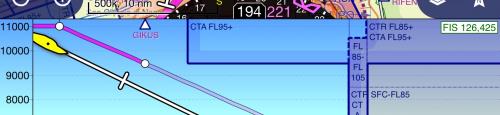
This area is crowded with military airspace, class D airspaces and controlzones of different airports.
Parts of the planning becomes useless and you have to do some ad hoc planning in flight in a complicated airspace structure.

But SD lets me look ahead only a few minutes, which is not enough for a 11000 ft standard descent.

Similar situations can occur during climb to higher altitudes.

Regards


GO

Merge Selected

Merge into selected topic...


Merge into merge target...


Merge into a specific topic ID...


Reading This Topic

Login

Explore
Messages
Mentions
Search