Hi
I am in the process of getting my PPL in Switzerland. After about 20hrs I did my second navigation flight last friday. I really like to learn to navigate only with the ICAO map at first, but I tried Skydemon the other day and I must say it is really great as a planing tool.
Here in Switzerland the airspace is really tight and we have lots of TMAs and almost during every flight we need a clearance to fly through them. To ask for the clearance it is really important to know the position of the aircraft, and due to the fact that the airspace is so small, the position of the aircraft has to be precise, my biggest problem with SD is that lots of names of "big" towns are missing, which in fact makes SD not usable for me at the moment.
I have read that lots of Swiss pilots have the same issue but I don't want to give up SD as it looks to be a promissing APP.
Is there a way to add the names that can be found on the ICAO map? Thank you for your help.
Regards,
Max
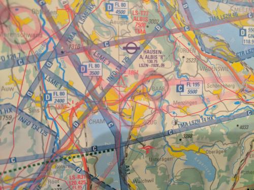
Here an example of what I mean:
ICAO Map:
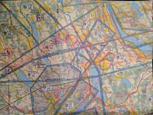
SD view: ( I have highlighted some of the cities for which SD doesnt show a name.)
Here a more detailed shot of the ICAO Map: