Hi Tim,
I certainly agree with you, Google Earth/maps and similar services from Microsoft and the like are showing, in some instances, outdated imagery, specially from places that are visited less frequently, this is why I mentioned the official cartographic institutions of the European countries. Most institutions consider the ortophoto the product to promote when there is a need for current cartographic data.
Why is this affecting SD, because I know for a act that it would be prohibitive for SD developers to cross check every airfield against proper cartographic data however we, the community, can do this job for you, let's put some example:

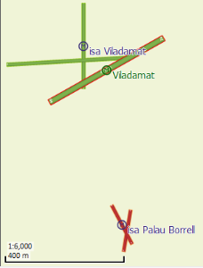
SD is showing Viladamat airfield (Spain) with the old runway configuration and is not showing another airfield located 500 metres south.

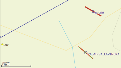
Now let's take a look Calaf airfield, the SD representation is about 1Km south where it should be ("isa Calaf" is correct).
And this can be made extensive to other airfields in my file.
I know I'm being a pain with the positional accuracy and all that stuff but being a land surveyor myself I have hard time trying to keep my mouth shut. Sorry about that.
Thanks for taking the time.
PS1: I believe it would be helpful to include some sort of "exclusion zone" in the DataCreator.exe so that we can hide stock data selectively.
Isaac