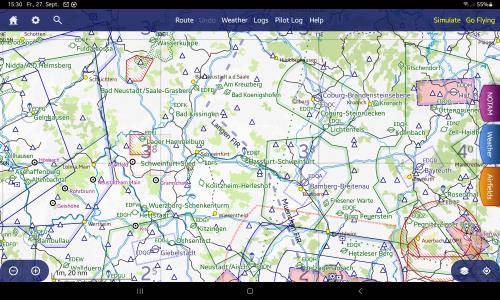
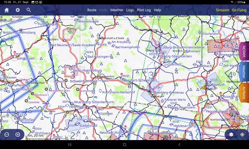
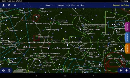
The display of the FIR boundaries is not really consistent across the different map styles.
While in the SkyDemon Grond Cover and Terrain view the FIR boundaries are displayed extremely thick and conspicuous, they are completely missing in the HighContrast and DFS view.
It would be nice if the FIR boundaries could be switched on or off like the FIS boundaries.
Here in Germany, the FIR boundaries are of little interest for VFR flights, whereas the FIS boundaries are very important. Here, the permanently displayed FIR boundaries are rather annoying and distracting.
Personally, I prefer the SkyDemon view over the DFS view, but I find the fixed and over-clearly displayed FIR boundaries somewhat distracting.
Couldn't the FIR boundaries be switched on/off? And then consequently also for all other map styles?
Examples:
As you can see, for a VFR Flght in Germany, the (more important) FIS limits are barely displayed, but the (rather unimportant) FIR limits are overly clear.

DFS and HighContrast/Night are no FIR at all

