SkyDemon Forums

Controlling automated climb/descent profiles

http://forums.skydemon.aero/Topic2746.aspx

By T67M - 4/30/2011 4:57:26 PM

I was just trying out a flight from Redhill to LeTouquet to see how well SkyDemon coped with the stepped-climb required to remain clear of controlled airspace, and found that while I could control the climb to some extent, I couldn't get exactly what I expected without adding in a LOT of extra waypoints. The best I managed is shown below:


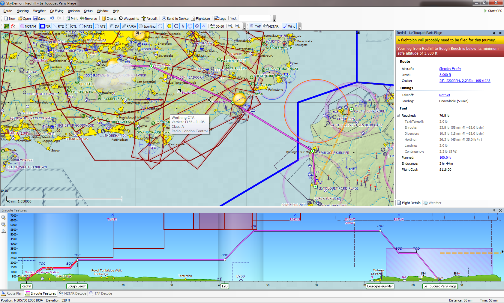
In particular, notice that the climb from 1400' to 2400' starts before Bough Beech not after it, thus causing the flight to enter CAS. Second, whereas I would like to step-climb (or even better, cruise-climb with SkyDemon suggesting a desired RoC in fpm) to remain just below CAS at all times, the actual profile created keeps me at 2400' all the way to LYD, then makes one long climb all the way up to FL054 (which, interestingly, is shown as 5400' despite the airspace being define as a flight level).


Am I doing something wrong, or is this something that isn't (yet) supported fully by SkyDemon?


Thanks,


T67M
By AM22 - 3/7/2023 5:53:00 PM

I agree with the other pilots!
When planning flights over different altitudes, it is sometimes very difficult to get the program to set the TOD, TOC, BOC and BOD points correctly.
Most of the time you try to set intermediate points in the route and shift the heights and waypoints until it fits.
At the latest when a flight plan is generated from the route planning or you shift your route into another system (Dynon or Garmin) for your autopilot, you realize how nonsensical this procedure actually is and you have to remove manually all unnecessary points.
Just give it a try and plan a flight across northern Italy and always try to fly as high as possible under airspace "D" and "C". It will be a real job!
My suggestion would be to make these points (TOD, TOC, BOD and BOC) movable within the Virtual Radar screen with the mouse or touch.
If the points can be moved separately, the appropriate climb or sink rate automatically results.
It would also be possible to color this climb or descent line in red (in the virtual radar) as soon as the rates exceed the capabilities of the set aircraft.
The programming effort should be manageable and would improve flight planing enormously.
Nevertheless, thank you very much for your great program! I love SkyDemon!