By derWessi - 4/25/2018 7:35:20 PM
Hi,
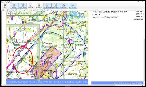
two weeks ago I planned a trip from EDCJ to EDCY. I planned the route parallel to the airspace D of Dresden airport (EDDC).
When I was looking at the printed chart, I discovered that the label with the height information for EDDC airspace D was missing. Instead only the airspace E information was depicted. (See attached picture)
I did some tests on android and it seems that the appearance of the airspace D label depends on whether the map section contains the label of the nearby airport EDAK or not.
It seems that showing the airport label has a higher priority than printing the airspace data. At least in this case I think that's a bad prioritization, esp since the label for airspace E suggests that all relevant information for the airspace is given.
I suggest to give the airspace label at least the same priority as the airport label and if necessary print them overlayed.
|
By Tim Dawson - 4/30/2018 8:31:51 AM
It's possible the label is off the bottom of the screen. In all charts, whether carographically put together or labelled automatically by a vector charting engine, there's the possibility a label will be offscreen or hidden by another label which has been placed first. You could always turn off class E airspace.
|
|