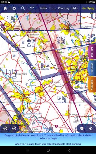
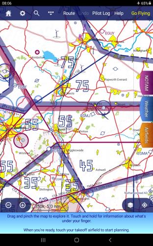
+x+xI would like to make a suggestion for , what glider pilots call, a Heights layer. This is available on Soaring Web for download; I use the Tim Newport Peace (.sua) format, and modify it slightly so that Skydemon can read it, and insert it as Custom Data. This puts a large number showing the maximum altitude one can fly to without entering controlled airspace. In practice that means rather than clicking on the map to find the beginning of controlled airspace, or looking at the cross section view at the bottom of the screen, I just need to look at the moving map main screen. Two screenshots are attached of the Heights Layer inserted:
 me
me
How do you distinguinguish between CAS bases expressed as Flight Levels and those as Altitudes?
The Heights Layer I use doesn't discriminate between the two, so care has to be taken. If I were to redesign it I would add a symbol, such as a dot before a flight level number (which I think I have seen in a gliding app), or have the number in a different colour.