By Chris_LSZO - 5/1/2020 7:48:58 PM
+xI like the new optics and FIR boundaries very much Are you sure you like it? Here another example:
Old Version:
New Version:
There are 3 problems for me: - Airspcace boundaries of Class D are not clearly visible like before - Airspcace boundaries of Class D and E have exactly the same style
- Can't hide the airspcace boundaries of Class E
@Tim: Is it possible to reinstall the old version on the ipad?
Chris
|
By Johannes B. - 5/2/2020 7:58:20 AM
+x+xI like the new optics and FIR boundaries very much Are you sure you like it? Here another example:
Old Version:
New Version:
There are 3 problems for me: - Airspcace boundaries of Class D are not clearly visible like before - Airspcace boundaries of Class D and E have exactly the same style
- Can't hide the airspcace boundaries of Class E
@Tim: Is it possible to reinstall the old version on the ipad?
Chris
You are right, airspace A through D should be easy to distinguish from E, and preferably with a thicker, transparent band. What I like is the decluttered optic, but in certain areas, as you pointed out, this is not sufficient. |
By Johannes B. - 5/2/2020 8:05:10 AM
The reason I am more fond of this new style is, that I am using the SkyDemon 1 map style, which shows airspace E as green shaded line, compare the screenshot.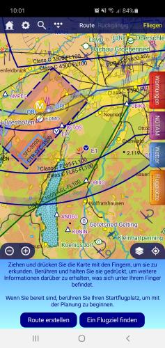 Regarding the DFS style, I am on your page.
|
By pilot-byom - 5/2/2020 8:47:19 AM
Since this topic appeared on several discussions I had a check for my own mission profile. First, I did not recognize a change as I am using Skydemon2 for German airspace, never liked the harsh (Gerrrmann? little and hard colors in that style sheet) DFS-stylish display.
Yes, I agree with fellow pilots that the current DFS-ish display of E is not the best. Yes, as an IFR traveller using Skydemon for VFR parts, I totally agree with Skydemon to NOT let airspace E be switched off. I can imagine the personal view of VFR-only, restricted microlight and ultralight pilots to ask for it, but folks - you are not alone in the sky! The always visible boundary between controlled and uncontrolled airspace is a sure safety benefit for all of us, in my opinion.
A Proposal: Change the color of airspace E boundaries to the greenish as in the Skydemon styles could be a compromise.
|
By Mike Stueber - 5/2/2020 9:45:34 AM
I would like to have back the choice to hide airspace E like before.The same would be great for the glider symbols at the places witch winch-launching. At the moment the are cluttering the chart, especially in the southern part of Germany. Mike
|
By Chris_LSZO - 5/2/2020 10:49:48 AM
+xThe same would be great for the glider symbols at the places witch winch-launching. At the moment the are cluttering the chart, especially in the southern part of Germany. 100% agree! The glider symbols are 5 times bigger then airports.... The same for the aerobatic symbols. Summary: The last updates have clearly made the program worse and I hope to be able to reinstall the old version.
Chris
|
By douglas5NR - 5/2/2020 1:36:09 PM
Yeah, optics and FIR boundaries look pretty awesome.
|
By Tim Dawson - 5/7/2020 11:31:33 AM
It's tempting to add a control for the size, but we hate adding options for things like this where only a few people dislike the default. Chris, have you already used the waypoint size control to make waypoints smaller? If so, we could tie it in to that, conceivably.
|
By Chris_LSZO - 5/7/2020 2:31:35 PM
+xChris, have you already used the waypoint size control to make waypoints smaller? If so, we could tie it in to that, conceivably. I use the opportunity, yes. but i set the waypoints greater than 100%. Same for the font size... I think you have to set that separately.
Chris
|
By Scoobydoo - 5/7/2020 2:33:12 PM
Tim do you already know, when the update will be available for iOs with the option of hiding Airspace E again?
|
By Chris_LSZO - 5/27/2020 10:29:55 PM
Hi Tim
There is just one thing: If I hide airspace E the boundaries are still visible in the virtual radar. Could you change this please? It's pretty confusing right now.
Chris
|
By Tim Dawson - 5/28/2020 9:44:15 AM
Hi Chris, that's always been the way in SkyDemon. It's our belief that no matter what the user has chosen to hide on the main map for convenience, the virtual radar should tell them exactly what is coming up and what they're flying inside.
It would be a significant failing on our part as a provider of safe aeronautical information if the user had no idea they were flying in class E airspace and there could be IFR operations all around them.
|
By Chris_LSZO - 5/30/2020 8:08:26 AM
Hey Tim I understand your intention. Here 2 screenshots: Top with airspace E bottom without. In the virtual radar you can only see 2 lines without a label and in the example below without reference to the display on the moving map.
In my opinion this is without added value in the cockpit situation and just clutter.
Chris
|
By Tim Dawson - 6/1/2020 11:46:03 AM
To me it suggests that one's route penetrates controlled airspace of some kind. We would be interested in hearing from others who would not only prefer to hide class E controlled airspace in virtual radar but could justify doing so from a safety perspective.
Again, SkyDemon has never permitted the hiding of class E controlled airspace in virtual radar, where ALL airspace is designed to be shown regardless of decluttering settings.
|
By Tim Dawson - 5/4/2020 8:53:02 AM
Chris, you asked me to look at some screenshots on page 1 and said do I really think this is a good idea. I cannot see anything in those screenshots that is a bad idea, so I am forced to ask you what you are referring to specifically.
Most people use the SkyDemon chart styles, which contain much more functionality that the ones intended to match some of the colours and line styles of paper charts. It seems that changes to our charting features in the latest version may have negatively impacted the DFS style which I will look into later this morning.
The shaded borders at the outside of airspace classifications, but not at every level change within those classifications, are a valuable decluttering feature in our main chart styles. I suspect that these were brought into our DFS style in an attempt to improve legibility, and perhaps they are not wanted, but I will investigate further.
These changes were in beta for approximately two months, with no adverse reaction whatsoever. If people don't like them we will consider revising them back, but do feel free to get involved in the beta programme if you'd like an early opportunity to give feedback on changes.
|
By iefbr14 - 5/4/2020 9:45:26 AM
+x... If people don't like them we will consider revising them back... I would be very happy to get the old DFS style back containing prominent airspace C & D markings.
Chears
Andreas
|
By Hetzenauer - 5/4/2020 10:36:20 AM
+xChris, you asked me to look at some screenshots on page 1 and said do I really think this is a good idea. I cannot see anything in those screenshots that is a bad idea, so I am forced to ask you what you are referring to specifically.
Most people use the SkyDemon chart styles, which contain much more functionality that the ones intended to match some of the colours and line styles of paper charts. It seems that changes to our charting features in the latest version may have negatively impacted the DFS style which I will look into later this morning.
The shaded borders at the outside of airspace classifications, but not at every level change within those classifications, are a valuable decluttering feature in our main chart styles. I suspect that these were brought into our DFS style in an attempt to improve legibility, and perhaps they are not wanted, but I will investigate further.
These changes were in beta for approximately two months, with no adverse reaction whatsoever. If people don't like them we will consider revising them back, but do feel free to get involved in the beta programme if you'd like an early opportunity to give feedback on changes. Tim- I think the reactions here came in very clear and fast. So I understand your reaction kind like.. the customers want it - they get it.. Good idea ;-) Regarding the beta test - challenge accepted! Where can I opt in? Best, Björn
|
By Tim Dawson - 5/4/2020 2:26:39 PM
SkyDemon beta information available here:
You can download a PC or Android beta right now, containing fixes to the issues with the DFS chart that people have written about on this thread. iOS betas take a longer time, but you can sign up for them and be notified whenever they are available.
|
By iefbr14 - 5/4/2020 3:14:42 PM
+xSkyDemon beta information available here:
You can download a PC or Android beta right now, containing fixes to the issues with the DFS chart that people have written about on this thread. iOS betas take a longer time, but you can sign up for them and be notified whenever they are available. Thank you Tim, for this quick fix. I'm happy to announce that this is looking fine again on the pc-beta. Are the aerobatic boxes also gone again? I found these location info's useful.
What do you think, would it be feasable to create airspace labels like these on the paper map? No idea weather this is also readable on an iphone display, maybe.
Thanks
Andreas
|
By JKL - 5/4/2020 5:13:51 PM
Dear Tim,
thanks for the quick reaction getting the DFS style back to the previous version. Tested both Beta versions (PC and Android). Best regards
Johannes
|
By Hetzenauer - 5/4/2020 6:02:41 PM
Ok, now here´s my first beta report regarding the lowered E airspaces in skydemon.
Unfortunately, they´re all wrong.
The reason is this: In Germany all airspace is declared as "E" airspace between 2.500´ AGL and FL100 (FL130 near the Alps). Since it is "everywhere" it isn´t depicted on the ICAO charts. Only those areas near CTR´s and RMZ´s, where it is lowered to 1.000´ AGL are shown separately on the (paper) chart, see this pic (courtesy of DFS): The area around the red arrows show the general vertical airspace boundaries between "G" and "E", while the yellow arrow shows a lowered "E" airspace (to 1.000´ AGL). These are the structures that are separately depicted on the ICAO chart and also in skydemon. However, in skydemon they are coded with an upper limit of FL100 (see pic below), which leads to frequent false alerts: in this case it tells me I´m leaving airspace "E" although my altitude is about FL065, which means I´m still inside "E"! These warning events ("exit"/"entry") happen several times when flying x-country for instance in FL65 - they are all wrong.
So, my solution would be this: hardcode these class "E" areas with an upper limit of 2.500´AGL. When an pilot flying in, let´s say, 2.000´ AGL, enters such an area, he or she gets warned like in the pic above - good thing, because these lowered airspaces are there for a reason. However, an pilot flying in FL75 way above that same RMZ the lowered "E" is made for is aware he´s flying in "E" all the time - and will not receive such a false alarm.
If those lowered "E" areas would then be coloured in green (or brighter blue...) like mentioned above in the DFS chart style, everybody would be happy - I guess...  Best, Björn
|
By Chris_LSZO - 5/4/2020 9:14:20 PM
Hey Tim
Maybe smaller glider, hangglider and aerobatic symbols (maybe adjustable?) and all would be very fine for me!
Thank you so much! The new Airspace labels are still impressive good.
Chris
|
By Tim Dawson - 5/11/2020 9:01:54 AM
Possibly later this week, but that isn't a promise.
|
By Tim Dawson - 5/5/2020 9:06:22 AM
Thanks all for the feedback. I'll address your questions one by one below.
Andreas: I do not know what you mean by aerobatic boxes. From memory, we hadn't had such things in our Germany chart but perhaps I am wrong. Regarding the airspace labels, that kind of labelling doesn't work too well with a dynamic chart like SkyDemon's, where airspace can be shown or hidden depending on user settings.
Hetzenauer: That's actually the way we used to encode class E airspace in Germany (with an upper limit of 2500' AGL and assuming the user knew that above that was still the general class E). We received a lot of complaints about that, by users informing us that the airspace actually went up to FL100 NOT 2500' AGL, which of course we knew, but there you go. One possibility would be for us to simply stop telling pilots when they enter or leave class E airspace, or perhaps stop telling them when they leave. I will leave that thought for further discussion here.
Chris: We've come under strong pressure lately for winch-launching symbology to be clear. They're just as dangerous as ground-based obstructions of course. We are open to reviewing the size of hang- and paraglider symbols and we'll wait to see what the general feedback is for them. It's very difficult striking a balance where the symbols convey their meaning properly in all the different locations throughout Europe where such activities are promulgated.
|
By Mike Stueber - 5/5/2020 1:10:42 PM
Hi Tim,thank you so much, that's now it's posssible again to hide Airspace E if one like to do so. The second huge problem is, that now at all the airfields, where glider flying takes place, the large glider symbol is present. And, worst off all, in your database you took all the smallest places where hang-gliding takes place.
Up to the last version this was hidden if one had not choosen under "airspace" the slider "Sporting Activity" .
Please, give us back this opportunity, now the chart is entirely overloaded with the glider symbols. Especially in the southern part of Germany. A slider like for airspace E for these symbols.
Many thanks.
Mike
|
By Hetzenauer - 5/5/2020 2:54:16 PM
+x[quote]Hetzenauer: That's actually the way we used to encode class E airspace in Germany (with an upper limit of 2500' AGL and assuming the user knew that above that was still the general class E). We received a lot of complaints about that, by users informing us that the airspace actually went up to FL100 NOT 2500' AGL, which of course we knew, but there you go.
 Ok ok, got it... Here they say: "Whatever you do - in the end it´s wrong"  How about inserting a trigger then which simply would disable warnings when flying above that threshold of 2500´ AGL? In that case no more false warnings would come up... Btw: GREAT costumer support, really appreciate your efforts! Thank you!
|
By Chris_LSZO - 5/5/2020 6:18:21 PM
+x It's very difficult striking a balance where the symbols convey their meaning properly in all the different locations throughout Europe where such activities are promulgated. Thanks Tim for discuss with us about all in this way, I appreciate that very much. What about my idea to give the opportunity to let us change the size of this symbols by a slider like with the font size? Then every user could customize it like he want.
Chris
|
By iefbr14 - 5/5/2020 7:41:52 PM
+x[quote]Thanks all for the feedback. I'll address your questions one by one below.
Andreas: I do not know what you mean by aerobatic boxes. From memory, we hadn't had such things in our Germany chart but perhaps I am wrong. Regarding the airspace labels, that kind of labelling doesn't work too well with a dynamic chart like SkyDemon's, where airspace can be shown or hidden depending on user settings.
I meant this little Aerobatix Box Drochtersen NW of LBV VOR is not on the PC-Beta (313.6.0) but on the iPad beta (313.6.234). This info is very useful
|
By Tim Dawson - 5/6/2020 8:28:04 AM
The areas of aerobatic activity can be turned off as they are Sporting airspace, perhaps you have done that.
Hang-gliding and paragliding areas can also be turned off as they are classified as Sporting airspace.
I think some of you may be asking us to turn off the display of winch launching cables, which would be quite dangerous. Can you confirm? Mike, I think this was you?
|
By Mike Stueber - 5/6/2020 9:50:29 AM
Hi Tim,I try to add a cut from the south of Germany. There are many glider symbols at places, where no glider traffic takes place. I believe these are places where hang-gliding etc. takes place. And it's not possible to hide these symbols. For my opinion it would be enough to see the glider-symbols at the airfields, which are not labeled with"G". At all the places wich are signed with "G" one know that there is glider-traffic and winch-launching. Kind regards, Mike
|
By Tim Dawson - 5/6/2020 11:05:34 AM
That symbol is shown wherever winch launching takes place. Even if it's winch-launching of hang-gliders. The cable will kill you just the same. You really want to hide this information?
|
By Chris_LSZO - 5/6/2020 5:48:19 PM
Why hide them?
Again: What about my idea to give the opportunity to let us change the size of this symbols by a slider like with the font size? Then every user could customize it like he want.
Chris
|
By JKL - 5/6/2020 7:17:08 PM
+xWhy hide them? Again: What about my idea to give the opportunity to let us change the size of this symbols by a slider like with the font size? Then every user could customize it like he want. Chris
Chris: I do not think that the size of the symbols is too large. Especially i flying mode they make you aware of possible quite dangerous areas. Johannes
|
By Hetzenauer - 4/30/2020 8:14:09 AM
Hi! I installed the latest update today on my iPad mini 5 and now I can‘t choose not to display lowered airspace E anymore...
The reason I want that is quite simple: it nearly has no importance for flying anymore but it often is located below C or D airspaces. Since it now is displayed exactly the same as the surrounding lateral boundaries of C or D airspaces it has great potential to be misinterpreted...
So my suggestion would be to either make the E airspace lines more transparent or in green colour like with your SkyDemon chart styles or provide us with an option not to display it at all.

Thx in advance, Björn
|
By grahamb - 6/1/2020 11:51:34 AM
+xTo me it suggests that one's route penetrates controlled airspace of some kind. We would be interested in hearing from others who would not only prefer to hide class E controlled airspace in virtual radar but could justify doing so from a safety perspective.
Again, SkyDemon has never permitted the hiding of class E controlled airspace in virtual radar, where ALL airspace is designed to be shown regardless of decluttering settings. Speaking as an IFR pilot who has nearly been hit by VFR traffic flying non-radio at an IFR level in Class E, I would rather people maintained some awareness of the class of airspace they are flying in! |
By Hetzenauer - 6/1/2020 4:31:18 PM
Excuse me but you‘re saying you fly IFR in between 1000‘ and 2500‘ AGL outside D & C airspace or a separate RMZ in Germany? Don‘t think so.
BTW: I‘m flying a lot VFR and IFR - either as an FI(A) or FE(A). Believe me: There is absolutely no need for a separate warning programwise here in German airspace.
However: since the option to hide these LOWERED „E“ airspaces has been restored and the old shaded borders are back this thread can be closed, I think.
Best, Björn
|
By pilot-byom - 6/1/2020 6:34:56 PM
*Disclaimer: this post may contain traces of cynicism*There are rather many flights obviously IFR-style in airspace E over Germany. You could see and almost hit a lot of them in the air during the holidays. Most of them might be only virtually IFR, because their glas cockpit addicted aircraft buttoneers never looked outside and are flying without officially declaring IFR. Their ATC is the false belief in moving map software, false belief in the use of navigational aids as primary, misbelief of physics in flight, false belief in collision avoidance technology, missing knowledge on what was called airmenship - feel free to add more items to the list. I hereby explicitly welcome Tim Dawsons Mantra repeating 'Skydemon is only a navigational aid' and does not replace brain (last my addition).
I still vote to always show ALL airspaces in ancient hope for pilots running on functional biological brains. |
By Tim Dawson - 6/2/2020 10:41:17 AM
Björn, I am interested in your assertion that there are no IFR operations in the lower class E in Germany. Could you explain that please? It would really help our understanding of the issue. Certainly outside of Germany class E is used extensively for IFR operations, and we must of course be consistent in our behaviour across international borders.
|
By Hetzenauer - 6/2/2020 9:07:58 PM
Sure I‘d like to explain my assertion...
Except for on published routings, namely SIDs and STARs (and approaches of course) in practice you won’t see IFR traffic inside the lowered E airspace parts in Germany. The reason is quite simple: Since no radar vectoring or IFR pickups are allowed below the MVAs starting at quite high altitudes or levels here in Germany (for those interested ENR 6-13 of the MilAIP might be a good starting point) you would have to cancel IFR to fly a direct-to below MVA for instance. Take my example of the lowered EDDL „E“ airspace south of EDLD for instance. It has never been used by ATC - but the higher „E“ airspace segments are used intensively for night arrivals into EDDL down to 3000‘ MSL...
Tim, please understand that „E“ airspace here isn‘t an additional element around some IFR airports leaving the rest as „G“ like in other European countries which justifies generation of warnings - it‘s all over Germany as one huge flat airspace between 2500‘ AGL and (mostly) FL100. Only where depicted on the ICAO charts its lower limits are pulled down to 1000‘ AGL - that‘s it. So if the program generates a popup saying „you just left „E“ airspace of XY“ that‘s simply wrong when you‘re flying at altitudes where there might be IFR traffic like in the example above. That‘s why people keep asking you to disable that function-it‘s misleading and blocks parts of the screen for its popup menues but provides no safety at all.
On the other hand we do see some FAFs inside E airspace where there are no extending C or D airspaces above the CTR, primarily at regional airports like EDDE and at altitudes of mostly around 2.5-3000‘ AAL. Since arrivals are vectored to those FAFs they seem to be a hotspot for near-misses between IFR and VFR traffic. That‘s where you‘ll find IFR traffic inside „E“ airspace in Germany.
Our suggestion was to mark these FAFs on the ICAO charts for awareness. However this was rejected for reasons unknown to me... Maybe SkyDemon could show them as an option in the future?
Currently we‘re talking about things like TMZ-H around RMZ protected airfields with the stakeholders. On the other hand collision avoidance cannot be granted by separation of airflows only since that leads to condensed VFR traffic around the edges of protected airspaces leaving a higher risk to those pilots flying uncontrolled (see your fantastic heatmap of traffic flows around London for instance).
In the end the only solution will be to SEE, BE SEEN AND AVOID - and this can only be achieved by implementing an electronic collision avoidance system inter-compatible between all users inside a specific airspace - starting with a glider, also an SEP and up to airliner traffic.
We‘re testing several solutions in practical flight tests around the research airport of Aachen as we speak although Covid-19 has slowed us down significantly. And since results are not yet validated I can‘t talk about it in public.
However we‘re using SkyDemon also-and it helps a lot in reducing the collision risk by displaying other traffic through various sources like the well-known AirTraffic module and others but mostly generating spoken traffic alerts via Bluetooth! This definitely shows an effect and we will evaluate this further.
Best, Björn
|
By Tim Dawson - 6/3/2020 9:39:33 AM
Thanks Björn, that is really helpful.
|