By oscarbal - 7/23/2015 7:29:30 AM
Hello Tim and others,
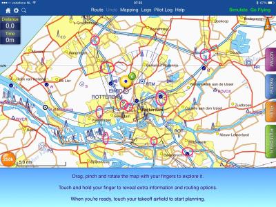
Let me start by saying the improved and more detailed charts are truly great, and provide enriched navigational support, especially in 'empty' areas. Looking in more detail, it looks like highways and also secondary roads are not always properly interconnected, where they are in real life. As an example I have checked the area around Rotterdam (NL) at a scale of 1:250k and marked the 'disconnects'. Zooming in further, I see the same happening with the secondary roads. I guess it's just a matter of tweaking some conversion tooling to resolve.
I recognize this improvement must have been an huge effort for the SD team, and it's already a big improvement now, with just about the right level of detail for aerial navigation.
Thanks!
|
By oscarbal - 7/23/2015 11:27:56 AM
Hi Tim, I had to look up the definition of slip roads, but I understand that now. However, most of the cases I marked as example, are merging/splitting highways (junctions/crossings?) and not really slip roads.
Anyway, it is not a big deal of course, and you have given it a thought of course.
|
|