By gb-rk - 4/14/2015 10:56:02 AM
Hi,
what is the reason that the charts, at least from Germany, are so inaccurate? Two examples:
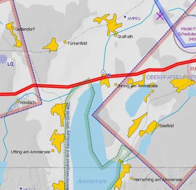
Ammersee: Why is the bird area as well as the control zone shifted by one or two kilometers to West?
Peissenberg:
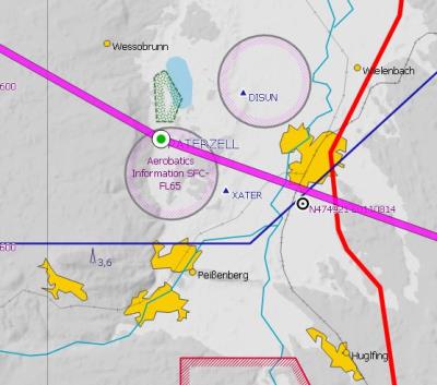
In the chart, the Ammer rivers flows through the village Peissenberg. This is definitely wrong! It flows about four kilometers east of Peissenberg.
What is the reason for these inaccurate charts? Is there an improvement to expect. it concerns all available chart styles.
This poor chart quality is not really a help for VFR flights. Is the any improvement to expect?
Gerhard
|
By lhe - 7/16/2015 5:20:37 PM
Hooray!
|
|