By MikeTwoOne - 3/23/2015 7:46:20 AM
Hi,
I've wrote about this a long time ago, in a beta-related post, but perhaps it deserves its own topic.
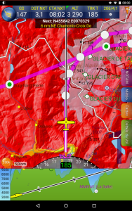
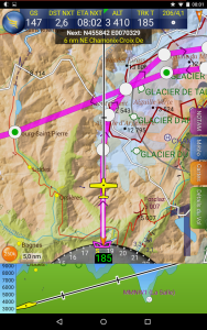
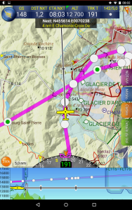
When flying in mountains (Alps, in my case), the chart is sometimes obstructed by a "white layer" that hides almost everything under it (map, terrainsafe info, ...).
It seems it has to do with glaciers, but I'm not sure. What I'm sure of, is that the map in this area is barely readable. That layer just hides everything without adding any value. It's exactly as having a hole in the map.
I remember reading that it was planned to remove that layer, but it's still here. Any news?
Thanks!
M
|
By Tim Dawson - 3/23/2015 10:27:15 AM
You make a good point. I agree that layer is not very helpful. I will see if we can remove it for our next scenery update, which will likely happen sometime during the summer.
|
|